Applications
Nodegoat
Open our Nodegoat Interface - Digital Periegesis Database visualizations
Link to filterable lists and map/network visualizations of the people, places, events, and narrative links annotated by the Digital Periegesis using the Nodegoat platform. ...
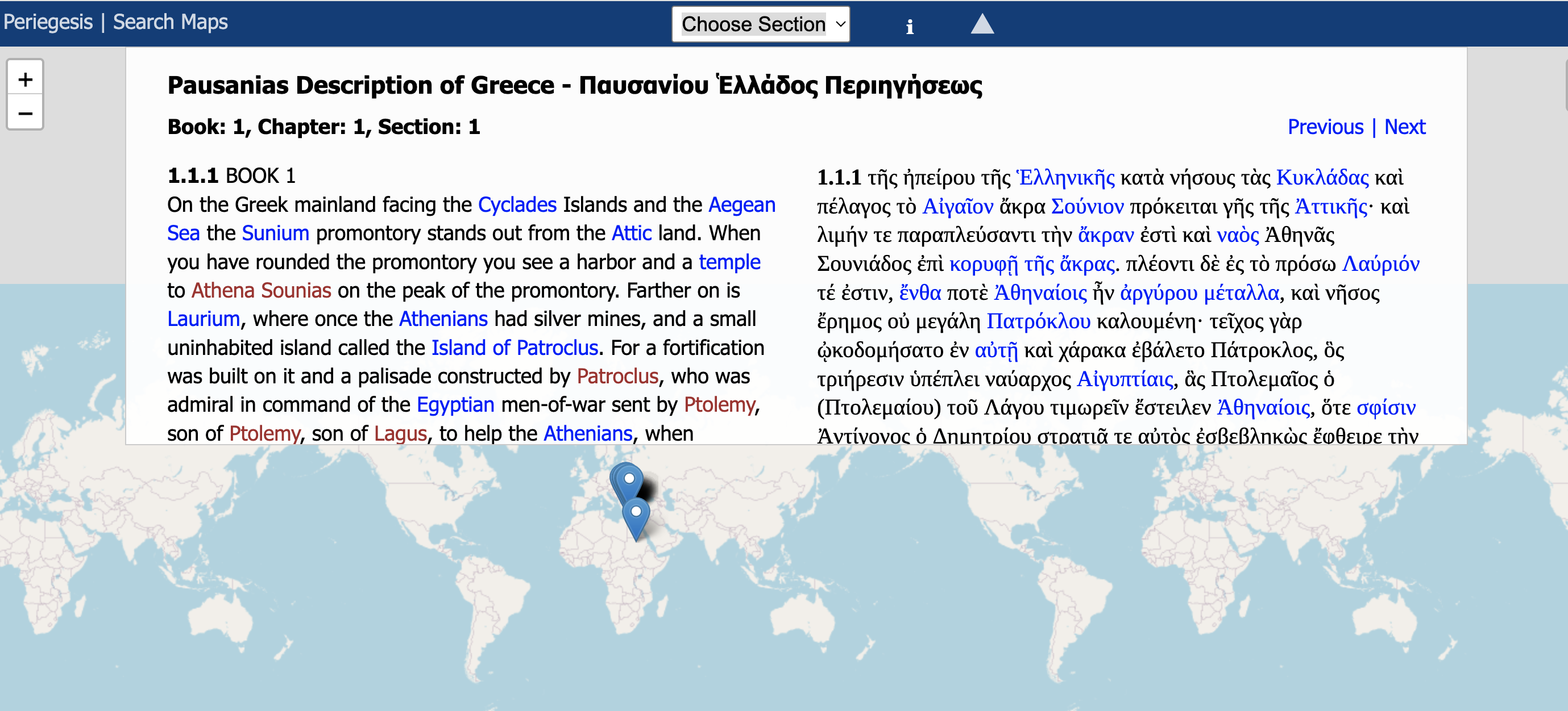
English-Greek text of Pausanias by Section with Places Marked on Maps
Side-by-side Greek and English text of Pausanias, by paragraph, with places and people extensively annotated with Wikipedia/Wikidata links and map display of tagged places in the Greek text....
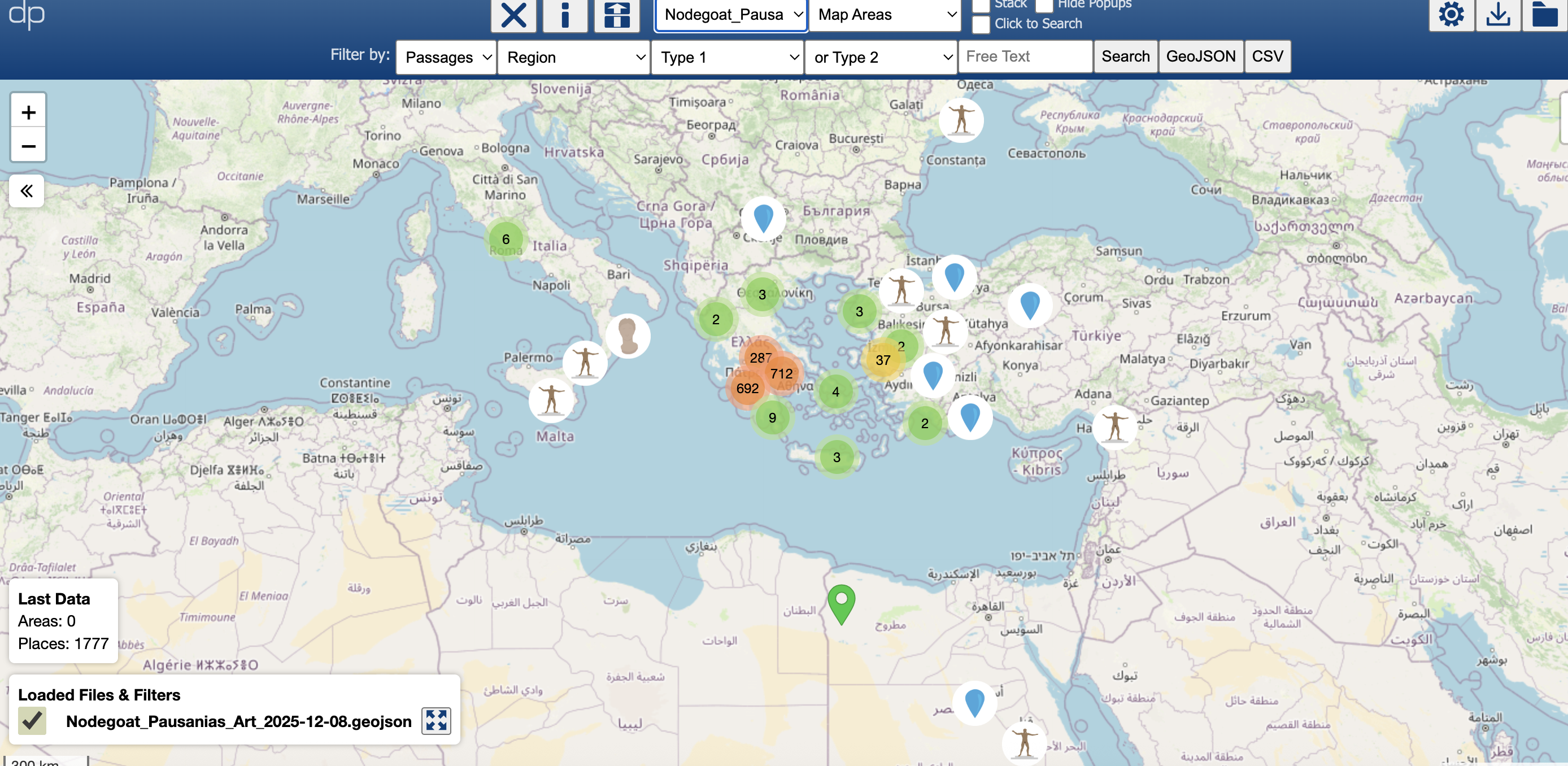
Mapping tools: Pausanias places and more
Preloaded/downloadable map files for the places and artwork described by Pausanias. Also, ToposText ancient places, and administrative maps of modern Greece with local government boundaries, settlements,...
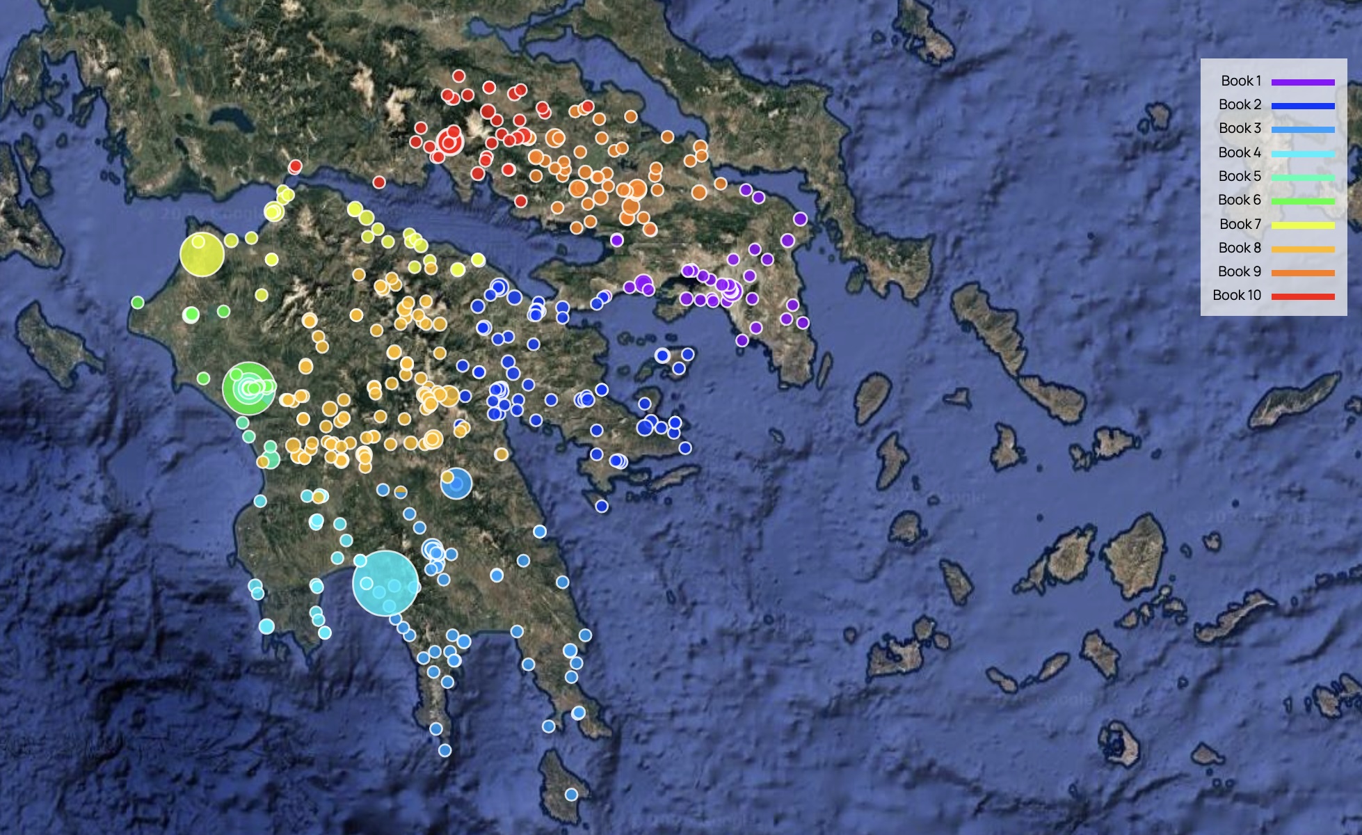
Date Geography of Pausanias Periegesis
2025-12-23
We assigned a narrative location to each of the 3170 paragraphs of the text of Pausanias, along with a notional date, one day per paragraph, between 160 and 175 CE. This allows us to visualize fairly neatly...
Search in Wikidata
Search a Dataset of 24 000 Historical and Mythological Persons - including those mentioned by Pausanias.
You can download the entire dataset as a CSV, XML or JSON file, or search and download parts of it....